Our Geographic Information Systems (GIS) services include maintaining a system of spatially referenced data to support the primary mission of the Campus Planning, Construction & Sustainability department as well as coordinating data needs of other Departments on campus. This includes collecting, creating and maintaining spatial information of all assets on campus for the College.
We are responsible for ensuring the ACC base map, utilities and other critical datasets are maintained. We work with other departments throughout ACC to provide custom map applications, systems and tools that rely on these geospatial systems. In addition, the data we maintain supports our interactive Campus Map, a web-based GIS map that contains information on all ACC’s buildings, parking, accessibility and other resources available on campus.
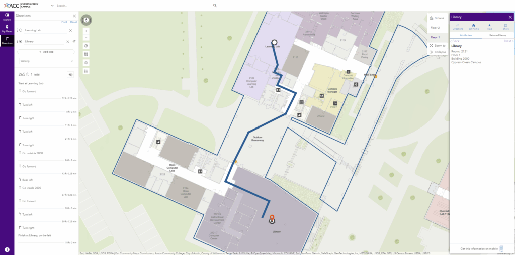
We have developed an Interactive Map for students and the ACC community to be able to search for and find any room they’re looking for. This is an example of the work that goes into developing this product from scratch.
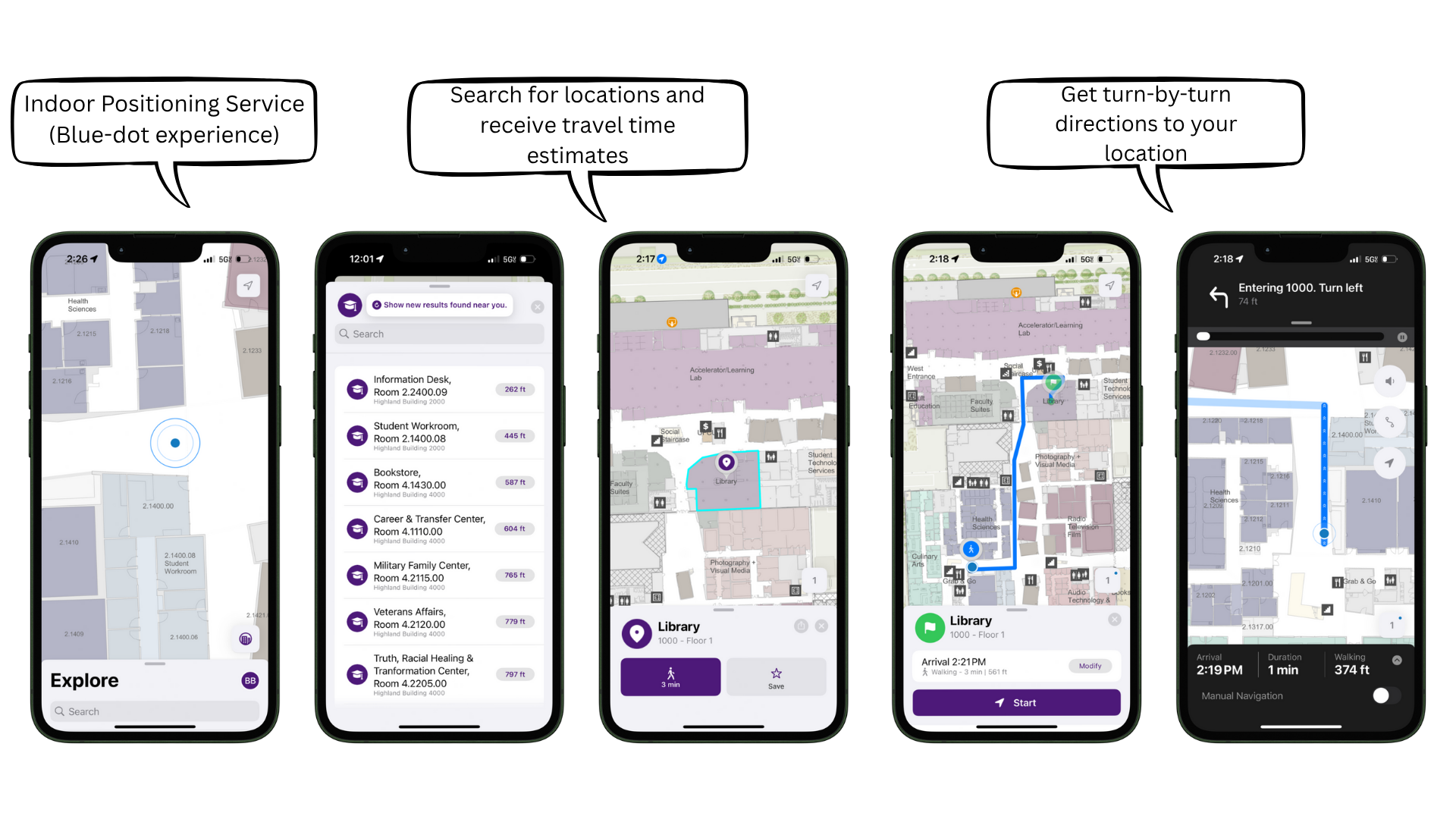
We have also created an Interactive Map App that you can download on your phone and get turn by turn directions as the app locates you in the building. Currently, this App is only available for our Highland Campus.